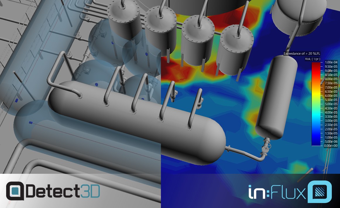
I have been writing recently about the benefits of Risk-Based Gas Mapping, but of course the Geographic approach has its advantages too: the analysis is cheaper, quicker, well-supported in industry, and has an appropriate level of detail for small or low-risk projects. Choosing the right method for your project can be challenging, especially as in:Flux has made risk-based methods more cost-effective.
Here are some broad-brush guidelines from my own experience with the two methods.
Use Risk-Based Mapping…
- On large projects that have significant risk associated with explosion or toxic gas transport. For these projects, modeling gas leaks to a higher standard using CFD is appropriate.
- For any project that involves significant toxic gas hazards, such as H2S. The benefits of risk-based gas mapping over geographic are particularly pronounced for toxic gas detection.
- Where a reduction in detector count results in significant cost savings.
Use Geographic Gas Mapping…
- When the project performance standard specifies it. Always defer to the governing documents and methodologies required for the project.
- On small, low-risk projects.
- For low-risk modules that are part of a larger project.
A combination of Risk-Based and Geographic Gas Mapping often makes sense. In that case, risk-based is best used on the high-risk areas, while geographic can be used on the other modules in the project.
As Detect3D and in:Flux can interface with each other, it is also possible to run both geographic and risk-based methods on the same module. Doing this provides valuable insight into the strengths and weaknesses of each layout, to support decisions regarding the gas detector layout.
Find us